
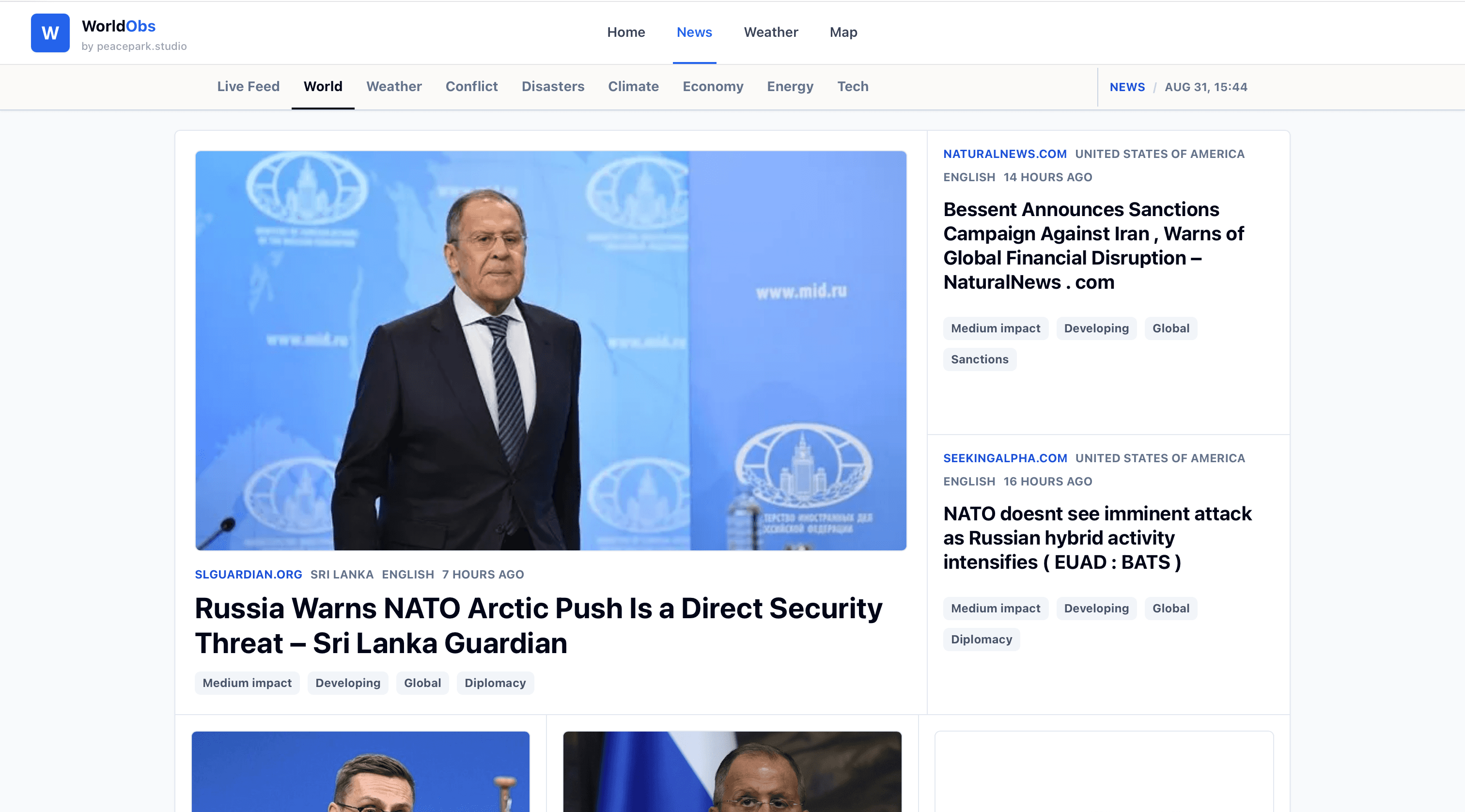
Global news feed
A live feed that groups world, weather, conflict, disaster, climate, economy, energy and technology stories with source, location, language, timing and impact labels.
Peace Park Studio venture
Follow global news, weather and climate on one live map.
A first-version global intelligence product combining live news, weather forecasts, radar, climate layers and event maps for cyclones, conflicts and disasters.
WorldObs is a first public version of a global news, weather and climate map.
The live product brings a major news feed, local weather, rain radar, forecasts and mapped global events into one fast interface.
World events and weather conditions often belong together. Storms, floods, conflicts, energy shocks and climate anomalies shape what people need to watch.
WorldObs starts from the practical need to move between headlines, location and live conditions without opening separate systems.
News is usually detached from geography, while weather maps are often detached from wider global context.
WorldObs treats news, weather and climate as connected signals that become more useful when they can be read by place, category and time.
The first opportunity is a focused public tool for scanning what is happening now: global stories, weather pressure, disasters, conflicts and climate signals.
Over time, the same surface can become a calmer intelligence layer for people who need to understand where events are unfolding and why they matter.
Peace Park Studio is building WorldObs around a live feed, category views for world, weather, conflict, disasters, climate, economy, energy and technology, local weather search, rain radar, forecasts and map layers.
The interface is intentionally direct: open the feed, inspect the map, check the forecast, then follow the source story when needed.
WorldObs is available as a first public version at worldobs.com.
Current work focuses on improving the live map, global news feed, weather views, signal classification, performance and the first useful research loops.
The next direction is to improve global news classification, event mapping and weather layers so WorldObs becomes a sharper daily observatory for live conditions and major global stories.
A live feed that groups world, weather, conflict, disaster, climate, economy, energy and technology stories with source, location, language, timing and impact labels.
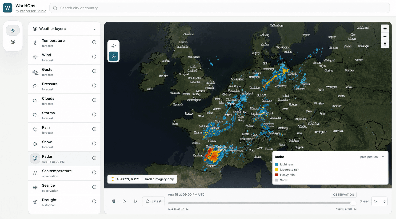
A weather intelligence screenshot showing radar precipitation over Europe with map context, timeline controls and layer navigation.
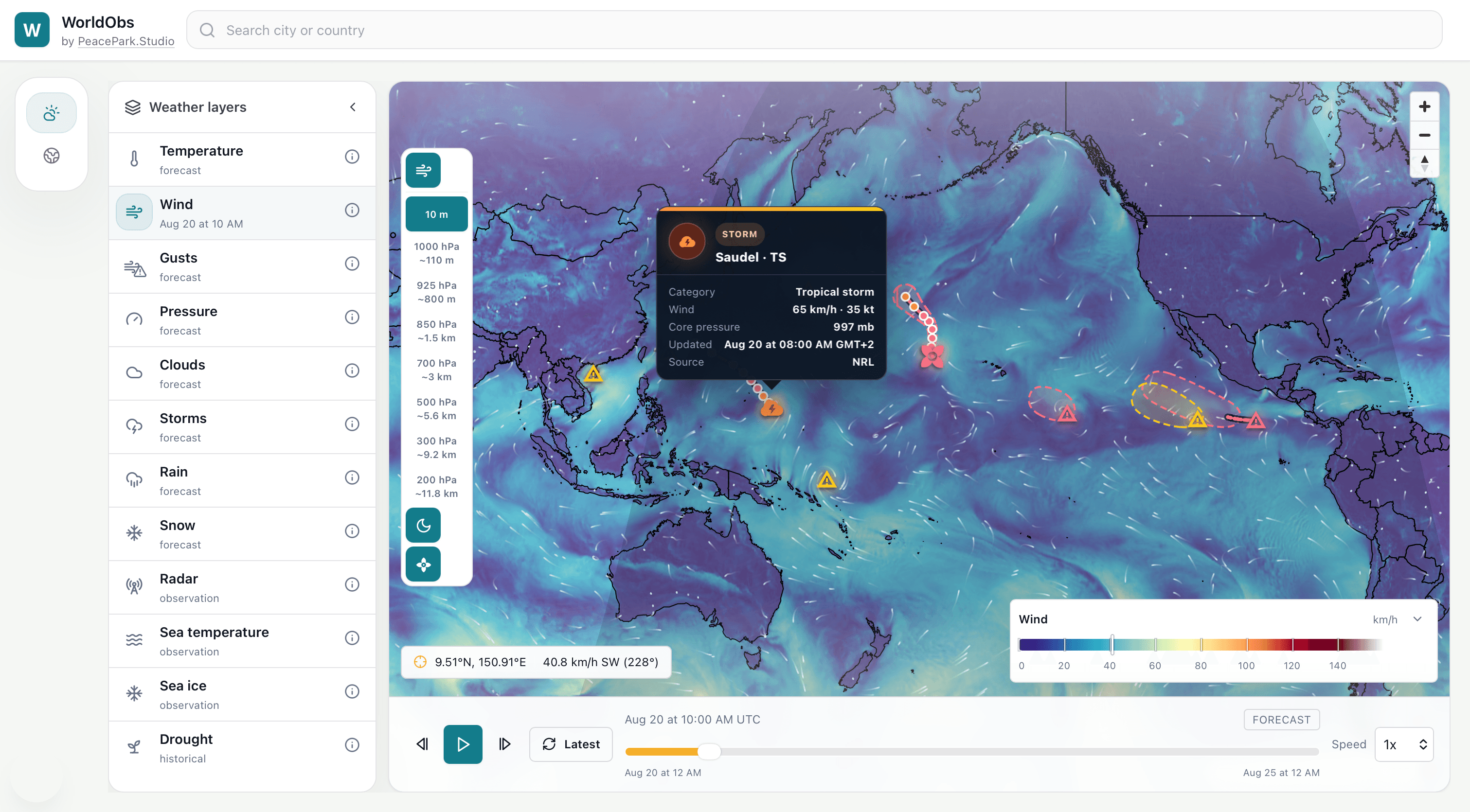
A Pacific map showing wind flow, tropical storms, hurricanes and ocean-scale weather alerts.